In all seasons you can relax in the nearby thermal center of Pejo Fonti
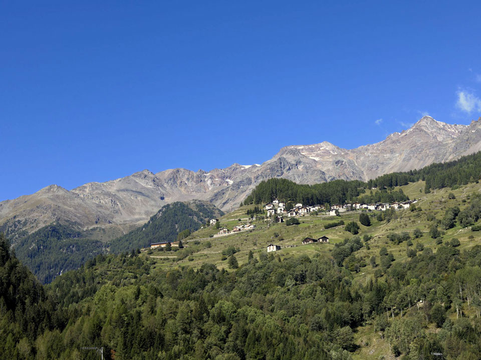
The Peio Valley and the Stelvio National Park (Trentino Dolomites)
You will be able to find all the best that the mountain environment can offer in all seasons, you will be able to walk peacefully in the woods or dedicate yourself to excursions of all types between lakes, refuges and huts. You will be able to enjoy magnificent landscapes and taste typical mountain specialties. Nearby the various sports centers will allow you to practice rafting, hydrospeed, canoeing and kayaking in the Noce stream or excursions, including guided ones, on mountain bikes, practice orienteering and many other disciplines ranging from children's activities to extreme sports. In the winter season you can take advantage of the cross-country trails that cross centuries-old woods and pine forests, and try your hand at the renovated slopes of Pejo Fonti. In all seasons you can relax in the nearby Pejo Fonti spa where treatments are offered for respiratory, circulatory and dermatological diseases as well as being equipped with a swimming pool, wellness centre, gym, etc.
• THE PEJO VALLEY
The Pejo Valley is characterized by the extraordinary and fascinating beauty and variety of environments, it is in fact a magical place, with mountains that exceed 3000 meters above sea level, but also highly evocative natural landscapes, such as wide valleys, streams of water that they come down from the mountains and woods of certain charm and attraction; both the summer and winter seasons offer the visitor the opportunity to fully appreciate and experience the enchantment of the valley, with outdoor and snow sports activities and excursions to the places of greatest interest. In winter the Valley transforms into a true paradise for lovers of skiing and snow sports, there are in fact numerous slopes, offering routes for every level of preparation, and the connections, lifts and structures are particularly efficient. accommodation, such as hotels and residences; in summer the tourist will be able to have fun on trekking and north walking routes, discovering uncontaminated territories, walking or cycling to visit the most beautiful villages and towns or try their hand at certainly exciting sports, such as rafting, hydrospeed or choose to follow canoe and kayak routes. The Pejo Valley is largely included within the Stelvio National Park, among certainly enchanting and highly evocative landscapes, woods and valleys, the territory is protected by the imposing presence of the Ortles Cevedale complex and the scenarios that are offered to visitors they are certainly of great charm and will be able to enchant the tourist.
• EXCURSIONS IN THE PEJO VALLEY
1) Rifugio Vioz
Departure: Funivia Peio Fonti (1383 meters)
Arrival: Rifugio Mantova al Vioz (3535 meters)
Excursion description
Itinerary that allows you to reach the highest refuge in the central and eastern Alps, at the foot of Mount Vioz (3645 m) from which you can enjoy an exceptional panorama of the Forni glacier. Departure from Pejo Fonti with the cable car to the Scoiattolo refuge and from here by chairlift (we recommend checking the opening of the lifts at the Peio cable cars) up to 2330 m of the Doss dei Gembri refuge where you take path 105 under the panoramic Vioz peak, the path goes up the eastern and western slopes of the mountain to alternately overlook the Mite and Zampil valleys; the track quickly gains an altitude of 3000 metres, meeting the only delicate stretch of the climb: the rocky prominence of the Brich, the passage is facilitated by the presence of a fixed rope, a saddle concludes the walk to the Mantova refuge where you can stay overnight. The Vioz peak is less than half an hour from the refuge from where you can admire a wonderful panorama of the Forni glacier with a view of all 13 peaks with the Adamello and Presanella Dolomites in the background.
2) Sentiero dei Tedeschi
Departure: Funivia Peio Fonti (1383 meters)
Arrival: Valle degli Orsi (2500 meters)
Excursion description
High altitude route that retraces the military track built by Austrian and German troops during the First World War. The itinerary starts from the arrival of the chairlift at the Doss dei Gembri refuge and taking path 139 it crosses Val della Mite towards the east and crosses the southern slopes of the Crozi di Taviela to arrive at the morainic amphitheater of Val Cadini and crosses Val degli Orsi, the places appear in their wild natural beauty; still today the route is marked by the old barracks and remains of military buildings which will not fail to attract the attention of the hiker. The mule track quickly descends to trail sign 122 to reach the ruins of the old fort. The way back crosses Frattasecca using the military road (SAT 124 trail sign) until you reach the 125 and quickly descend to Peio Fonti.
3) Lago Palù - Passo della Sforzellina
Departure: Rifugio Fontanino (1675 meters)
Arrival: Passo della Sforzellina (3006 meters)
Excursion description
After Peio Terme, at Fontanino take the forest road on the right, up to the lake and the Giumela hut (1947 m). A mule track continues easily towards Malga Paludei, used as a bivouac, the landscape is embroidered with dense woodland vegetation and pastures, rippled in the hot season by rich alpine flora. Path 110 then leads towards the Sforzellina pass. (3006 m), at the foot of the Corno dei Tre Signori (3559 m), to discover the sources of the Noce river and along the ancient "via dei cavai". The pass overlooks the Gavia valley. Shortly after Malga Paludei, a challenging variant leads to Val Piana. The area is worth a visit, because it offers a wild environment populated by a rich fauna (sightings of chamois and marmots in the early hours of the morning); During the excursion, nature enthusiasts will also be able to admire rare floral species up close and observe the peculiar geological phenomena that contributed to creating this Alpine Eden. Then the path climbs towards Punta San Matteo (3678 m), scene of the daring battles of the "Great War" in 1918.
4) Rifugio Larcher e laghetti
Departure: Centrale ENEL Malga Mare (1972 meters)
Arrival: Rifugio Larcher (2608 meters)
Excursion description
The beauties of the Cevedale group are summarized in this itinerary which, although not touching the eternal ice, offers hikers the essence of walking in the mountains. From Malga Mare (reachable by car from the town of Cogolo or on foot from Peio Paese from paths 105 and 127) take path 102 and climb along the impervious slope covered in vegetation to reach Pian Venezia where there is a refuge-hut (2290 m). Val Venezia forms a large basin with the course of the Noce Bianco stream in the center and moved by undulating reliefs and large pastures, it is closed to the west by the Vioz and Palon de la Mare chains. The path, keeping to the orographic left, leads to the Larcher refuge located on a recently renovated rocky balcony. From here the panorama extends over the peaks of Cevedale and the surrounding glacier. The excursion continues towards Lago delle Marmotte following trail signs 104 and 123. Keeping to path 123, the circular tour cuts across the southern side of Careser, above Lungo lake to reach the Nero lakes and Careser lake (hydroelectric basin) and after passing the base of the dam, the path turns south at Lame (2430 m) then continues rapidly descending between slopes broken by pastures to dive into the coniferous forest to return to the power plant square.
5) Tredici Cime
Departure: Rifugio Larcher (2608 meters)
Arrival: Passo Gavia o Peio Valley
Excursion description
Classic and wonderful mountaineering traverse, starting from the Larcher refuge, through 13 peaks, all above 3000m in the Ortles Cevedale group. The route winds for about 17 km, with an ascent and descent difference in altitude of 1750 m and 1920 m respectively, over glaciers and snowfields of medium difficulty. The itinerary requires good mountaineering preparation, adequate equipment (ice axe, rope and crampons) and the accompaniment of a mountain guide. From the Larcher refuge, go up path 103 to Passo della Forcola and continue on the ridge up to the Zufall peak (1st peak 3757 m), still on the ridge you pass the Cevedale peak (2nd peak 3769 m) highest point, descend at the Colombo bivouac and climb towards Palon della Mare (3rd peak 3703 m) concluding the first day at the Mantova refuge on Mount Vioz (4th peak 3645 m) where it is advisable to stay overnight to resume the next morning attacking the more demanding stretch that from Mount Vioz passes Punta Taviela (5th peak 3612m), Cima Peio (6th peak 3549m), Rocca di S. Caterina (7th peak 3529m), Punta Cadini (8th peak 3524m) and then stay overnight at the Meneghello bivouac. Beginning of the third day with the ascent to Mount Giumella (9th peak m 3594), to Punta S. Matteo (10th peak m 3678), descent to the Dosegù peak (11th peak m 3560), at high altitude until you reach Punta Pedrazzini (12th peak 3599 m) and finally Pizzo Tresero (13th peak 3594 m), the last peak of this extraordinary traverse. The return can take place in the direction of the Gavia Pass or by descending from Tresero or S.Matteo towards Lake Palù and the Peio Valley.
Request more information

Location of the Casa al Sole residence with apartments and map
The "Casa al Sole" is a residence located in Cogolo, in the heart of the Pejo Valley, within the Stelvio National Park.
One of the peculiarities of the residence, in addition to the beauty of the structure, is the climate you can breathe. The house is family run. For us, anyone who decides to spend a few days at Casa al Sole is not a customer but a guest as welcome as a friend.
During the summer period we will accompany you to visit mountain huts and refuges or to have picnics not as tourists but as locals.
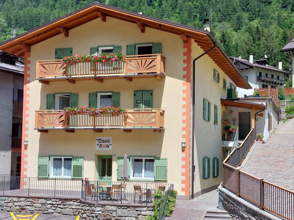
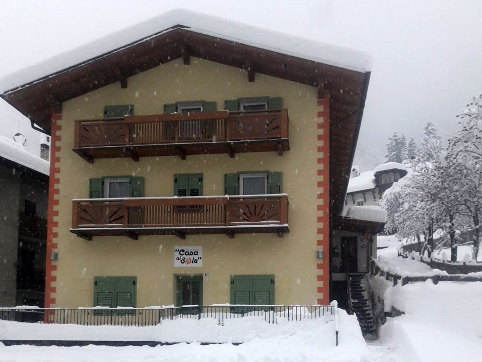
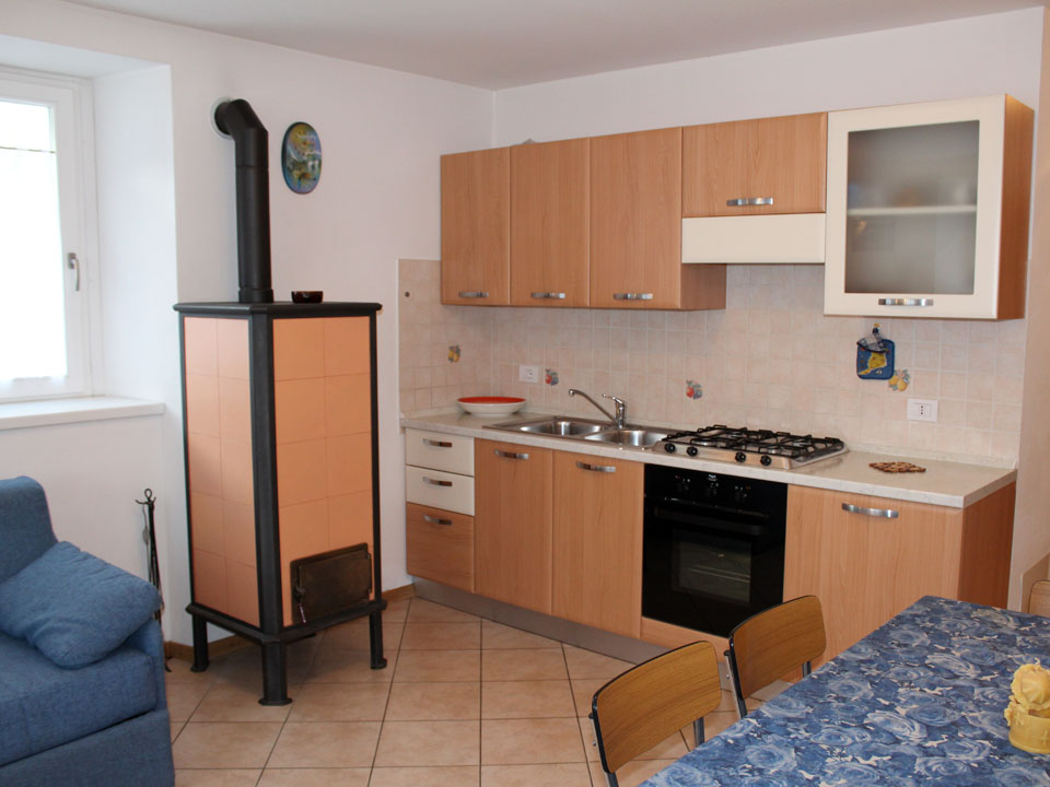
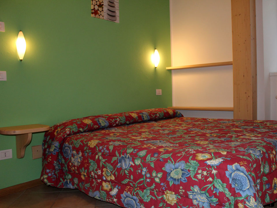
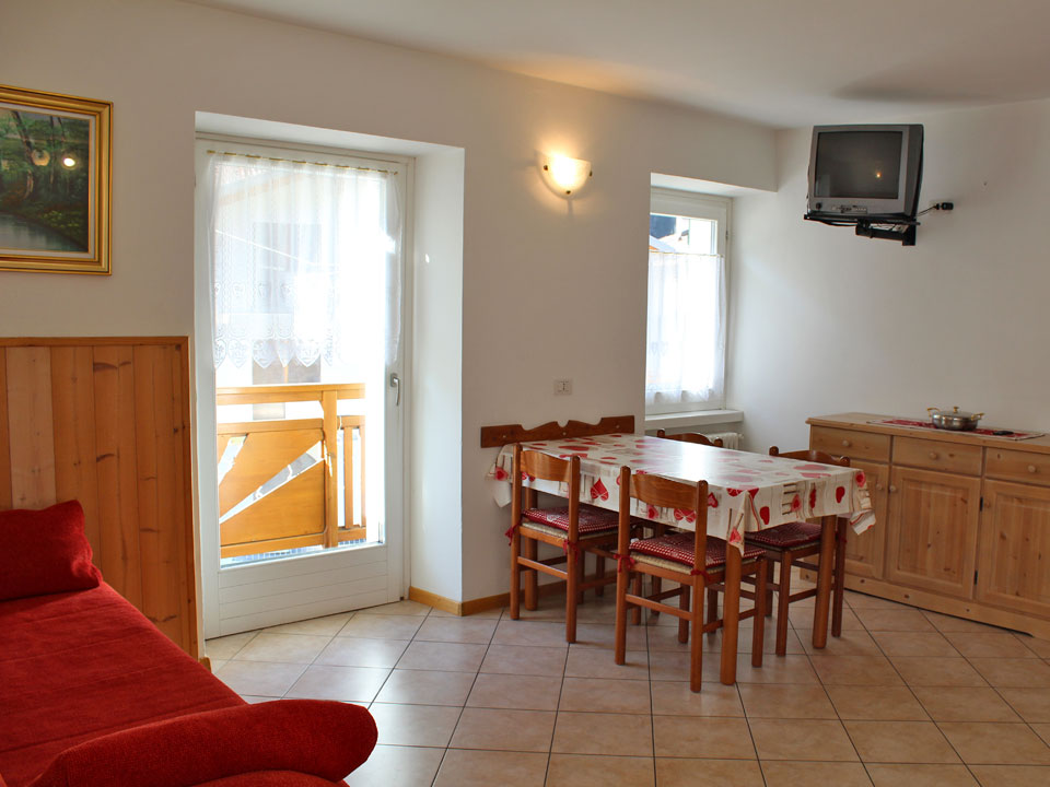
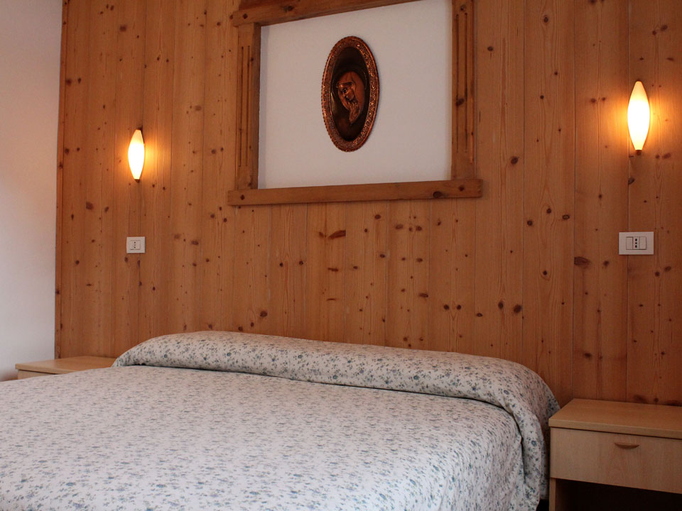
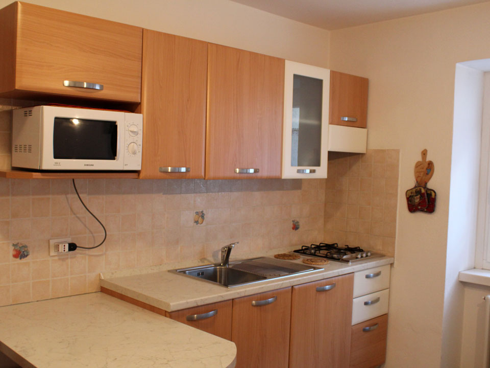
The apartments are recently built, the structure remains open all year round and reservations are also accepted for weekends.
The apartments are located in a strategic position that allows you to enjoy the maximum tranquility that the mountain offers and at the same time the center is easily reachable in a few minutes on foot.
The Pejo Valley is characterized by the extraordinary and fascinating beauty and variety of environments. In all seasons you can relax in the nearby Pejo Fonti spa where treatments are offered for respiratory, circulatory and dermatological diseases as well as being equipped with a swimming pool, wellness centre, gym, etc.
Follow us on Social
Contacts
-
Via Roma n.61
38024 - Cogolo - Peio (TN)
Pejo Valley
ITALY -
Call us at +39.0463.754403
-
Call us at +39.334.1913000